Cowboy camp on summit of Mount McLoughlin - forest near Imagination Peak
4 miles from Mount McLoughlin back to PCT + PCT mile 1775 - 1789
Total 18 miles
For the first time in my life I have woken up on top of a volcano this high: the 9495 ft high summit of Mount McLoughlin. The night was cold and windy, but the one-person bivy site provided a comfortable sleeping spot. In the night I woke up several times and gazed at the stars. In the second half of the night, perhaps a couple of hours before sunrise, Orion showed up in the southern sky - a sure sign that the summer is slowly coming to an end.
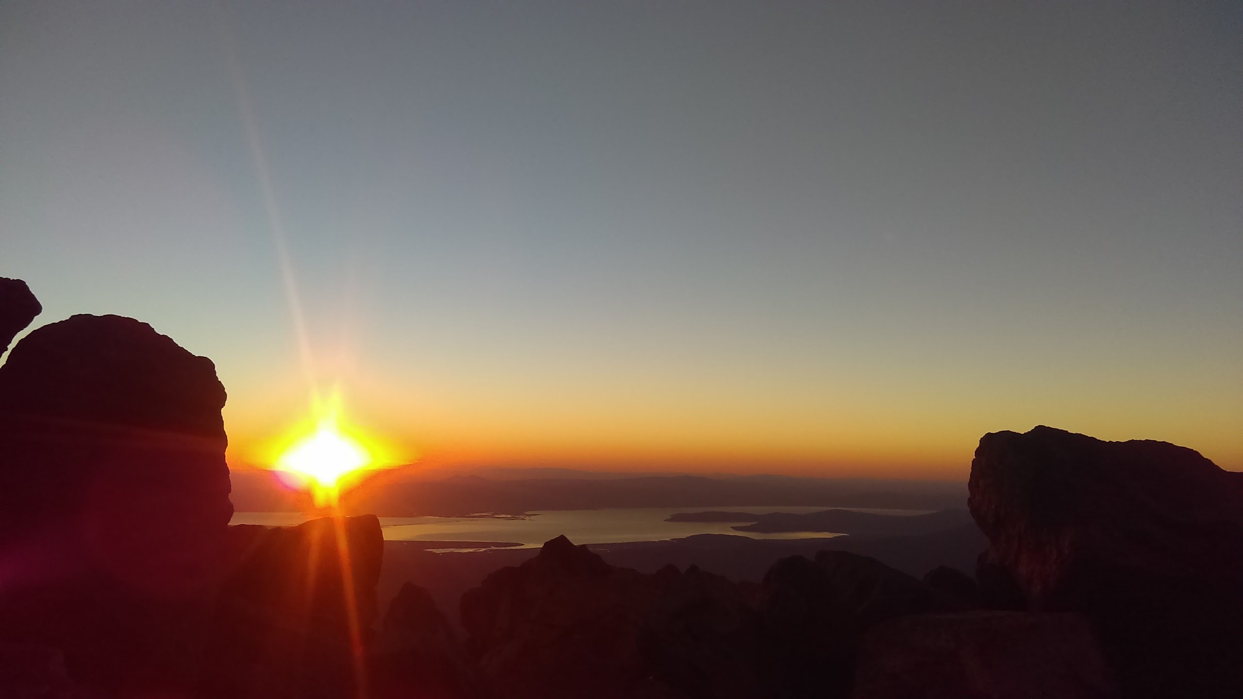
The eastern half of the sky is turning from dark blue to white with shades of red on the horizon as the time of sunrise approaches.


Immediately after sunrise the volcanic cone is again throwing a triangular shadow, this time on its west side.


Staying inside my sleeping bag, I make a "breakfast in bed": oats and hot tea. Shortly after eating breakfast an emergency arises: I need to use the restroom. I am well prepared for the emergency case and poop inside a double ziploc bag. I close the ziploc bag, put it in the back pocket of my backpack, and I'm going to carry it down into the forest. There I'll dig a proper cathole, put the poop inside the cathole, and carry the empty dirty bag to the next town. Apologies for a graphic image :-) No, I didn't forget the shit bag up there. I successfully carried it all the way down.

It is around 10 AM when I hear first human voices. Three boy scouts have just reached the summit. They are soon followed by more scouts. It is time for me to start going down. I would have stayed for longer, but my water supply is limited and the distance to the next water source is 13 miles. I navigate my way down the mountain, saying hi to more scouts on the way. The size of the group is 50 scouts and many of them are Mormons. They are surprised when they see my BYU hat :-)


Finally I am back in the forest where I can dig a proper cathole for my poop and then continue walking north on the PCT. On the north side of a low forested saddle the shrubs under the trees suddenly change. The bushes have dark purple, blue and black colored berries: blueberries!


It is time to stop and enjoy the gifts of nature. Then I arrive at Christy's Spring with abundant water. The six liters of water that I filled up yesterday morning were calculated well; my water bottles are almost empty. I fill up water for the next 14 miles and slowly continue walking, stopping many times on the way to taste the delicious blueberries. The blueberries look a bit different than the ones I know from Central Europe or Scandinavia. The shrubs and the leaves are much bigger. In Czech I think we call them "Kanadské borůvky" ("Canadian blueberries"). Another signal that Canada is not too far away! The further north, the better the food along the trail gets.


As the sun starts hiding behind the trees, the PCT starts to resemble an obstacle course. Every few steps there is a fallen tree to climb over, crawl under or walk around. It is time to start looking for a safe and hidden camping spot. After a few tries, I find a bare and flat spot about 100 feet off-trail where I build my tent, crawl inside, and fall in deep sleep.

4 miles from Mount McLoughlin back to PCT + PCT mile 1775 - 1789
Total 18 miles
For the first time in my life I have woken up on top of a volcano this high: the 9495 ft high summit of Mount McLoughlin. The night was cold and windy, but the one-person bivy site provided a comfortable sleeping spot. In the night I woke up several times and gazed at the stars. In the second half of the night, perhaps a couple of hours before sunrise, Orion showed up in the southern sky - a sure sign that the summer is slowly coming to an end.
The eastern half of the sky is turning from dark blue to white with shades of red on the horizon as the time of sunrise approaches.


Immediately after sunrise the volcanic cone is again throwing a triangular shadow, this time on its west side.


Staying inside my sleeping bag, I make a "breakfast in bed": oats and hot tea. Shortly after eating breakfast an emergency arises: I need to use the restroom. I am well prepared for the emergency case and poop inside a double ziploc bag. I close the ziploc bag, put it in the back pocket of my backpack, and I'm going to carry it down into the forest. There I'll dig a proper cathole, put the poop inside the cathole, and carry the empty dirty bag to the next town. Apologies for a graphic image :-) No, I didn't forget the shit bag up there. I successfully carried it all the way down.

It is around 10 AM when I hear first human voices. Three boy scouts have just reached the summit. They are soon followed by more scouts. It is time for me to start going down. I would have stayed for longer, but my water supply is limited and the distance to the next water source is 13 miles. I navigate my way down the mountain, saying hi to more scouts on the way. The size of the group is 50 scouts and many of them are Mormons. They are surprised when they see my BYU hat :-)


Finally I am back in the forest where I can dig a proper cathole for my poop and then continue walking north on the PCT. On the north side of a low forested saddle the shrubs under the trees suddenly change. The bushes have dark purple, blue and black colored berries: blueberries!


It is time to stop and enjoy the gifts of nature. Then I arrive at Christy's Spring with abundant water. The six liters of water that I filled up yesterday morning were calculated well; my water bottles are almost empty. I fill up water for the next 14 miles and slowly continue walking, stopping many times on the way to taste the delicious blueberries. The blueberries look a bit different than the ones I know from Central Europe or Scandinavia. The shrubs and the leaves are much bigger. In Czech I think we call them "Kanadské borůvky" ("Canadian blueberries"). Another signal that Canada is not too far away! The further north, the better the food along the trail gets.


As the sun starts hiding behind the trees, the PCT starts to resemble an obstacle course. Every few steps there is a fallen tree to climb over, crawl under or walk around. It is time to start looking for a safe and hidden camping spot. After a few tries, I find a bare and flat spot about 100 feet off-trail where I build my tent, crawl inside, and fall in deep sleep.


