Thursday, 29th October 2016
Cowboy camp in Waptus River valley - forest near Glacial Lake
Mile 2425 - 2448
total 23 miles


Voices of squirrels were like a signal announcing a new day when I woke up looking at branches of giant conifer trees. The place where I slept was a perfect hidden camping spot situated on the flat bottom of the U-shaped, glacially formed Waptus river valley. The night had been warm and dry, the only exception being a couple of tiny water droplets condensating on the tree canopy and hesitantly falling down. A cup of hot tea and two big bowls of almost perfectly prepared hot oats with rich trail mix of nuts and seeds gave me energy to get up fast and start walking to a bridge across the glacier-fed Waptus River, and continuing gently uphill through a valley of one of it's tributaries, into a woodland with colorful maples, and past a narrow gorge with a white waterfall and sweet huckleberries on exposed shallow rocky soil. On the trail I saw two people; One of them was Josh whom I taught about edible berries and who was still sleeping in his tiny tent; Another kind person was the hiker with a moniker "Samples", whom I had been meeting and greeting many times in southern California, Oregon, and now again in Washington.


The wilderness in the Cascade had been reminding me of the Sierra Nevada in many ways. Both mountain ranges owe their present shape to glacier action and both have plenty of water to drink and stretches with high elevation gain. However there are some key differences. 6000 ft elevation in the Cascades hosts similar trees and shrubs as 11000 ft elevation in the Sierra; The atmosphere in the Cascades is more dense, more humid, and easier to breathe; And the PCT stretches outside civilization are shorter in the Cascades, the longest stretch between roads being 107 miles, compared to the high Sierra's 180 miles. Other differences are due to time of year. September and early October are the richest times of year in the high country of the Wild West, with virtually no mosquitoes, and an abundance of edible fungi and berries. I believe the hikers who are now in the Sierra Nevada a good berry and mushroom harvest.


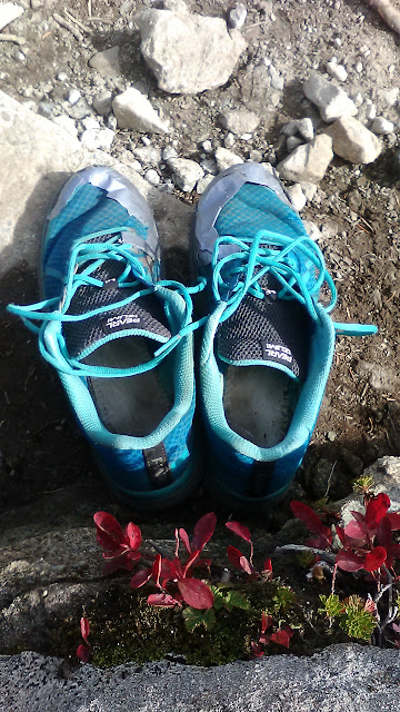
The sharp peak above was given a name "Cathedral Peak". Around noon I reached a high elevation saddle under the peak in 6000 feet. The sun showed up at the same time. I spent three hours up in the saddle, cooking delicious food, drying the remaining damp parts of my sleeping bag and tarp, and trying to use duck tape to seal the holes in my "Pearl Izumi" shoes. My second pair of shoes had lasted 1150 miles; the third pair, on the other hand, is barely holding together after less than 800 miles. It would be interesting to see if the lifetime of hiker shoes on the PCT follows a bell curve; and if the hypothesis that four or more pairs of shoes are required to walk the 2650 mile distance can be rejected, and how much of an outlier my last 1150-mile shoes had been.


More pictures of Cathedral Peak from other angles:


North of the saddle the trail crossed a silty, gray colored glacier-fed stream. In many places volunteers had recently repaired the pathway, making the walk very comfortable.


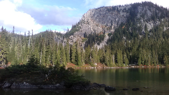
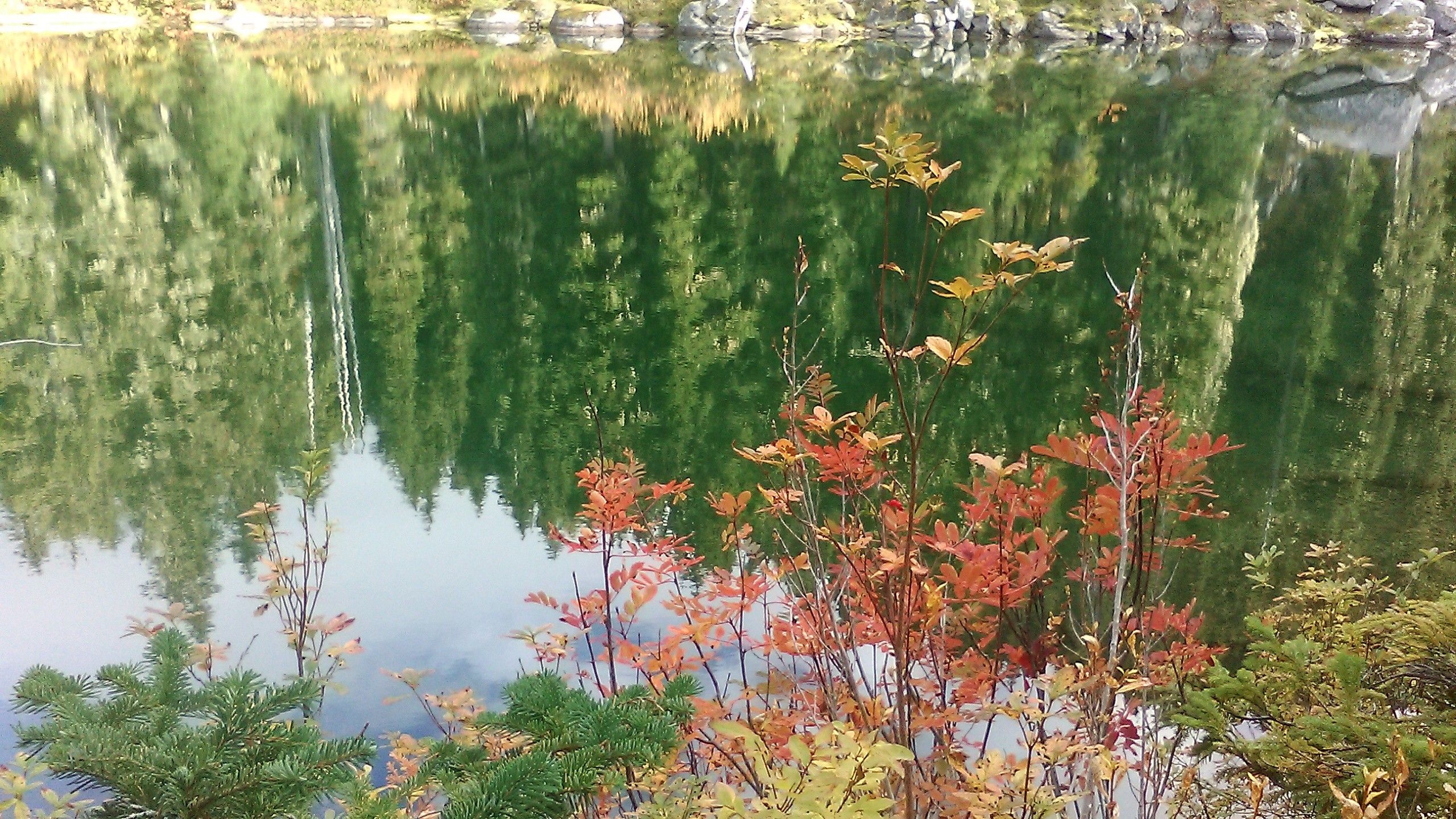
The name of the next pass was "Deception Pass", probably because the top of the saddle is not the top off a long uphill climb. After Deception Pass the uphill continued on other side of a ridge, crossing glacial moraine and reaching a lake named "Deception Lake".


More photos of Deception Lakes with their tiny islands:


North of Deception Lakes the path kept on climbing steadily almost above the tree line. Thick clouds and fog started filling the surrounding valleys. Was that a sign of weather change to a cold and wet pattern? It was hard to tell.


I descended through a field of huge rocks towards forest near a lake named "Glacial Lake". There I met the hiker "Samples" again. He was asking me if tomorrow was the last day of my journey. I answered: "Tomorrow the mountains will decide" and after some searching found a hidden spot away from water and under large trees, where I built my tent. Tomorrow at Stevens Pass I would find out if this was my last night on the PCT, or if the mountains would allow me to be their guest.
Cowboy camp in Waptus River valley - forest near Glacial Lake
Mile 2425 - 2448
total 23 miles


Voices of squirrels were like a signal announcing a new day when I woke up looking at branches of giant conifer trees. The place where I slept was a perfect hidden camping spot situated on the flat bottom of the U-shaped, glacially formed Waptus river valley. The night had been warm and dry, the only exception being a couple of tiny water droplets condensating on the tree canopy and hesitantly falling down. A cup of hot tea and two big bowls of almost perfectly prepared hot oats with rich trail mix of nuts and seeds gave me energy to get up fast and start walking to a bridge across the glacier-fed Waptus River, and continuing gently uphill through a valley of one of it's tributaries, into a woodland with colorful maples, and past a narrow gorge with a white waterfall and sweet huckleberries on exposed shallow rocky soil. On the trail I saw two people; One of them was Josh whom I taught about edible berries and who was still sleeping in his tiny tent; Another kind person was the hiker with a moniker "Samples", whom I had been meeting and greeting many times in southern California, Oregon, and now again in Washington.


The wilderness in the Cascade had been reminding me of the Sierra Nevada in many ways. Both mountain ranges owe their present shape to glacier action and both have plenty of water to drink and stretches with high elevation gain. However there are some key differences. 6000 ft elevation in the Cascades hosts similar trees and shrubs as 11000 ft elevation in the Sierra; The atmosphere in the Cascades is more dense, more humid, and easier to breathe; And the PCT stretches outside civilization are shorter in the Cascades, the longest stretch between roads being 107 miles, compared to the high Sierra's 180 miles. Other differences are due to time of year. September and early October are the richest times of year in the high country of the Wild West, with virtually no mosquitoes, and an abundance of edible fungi and berries. I believe the hikers who are now in the Sierra Nevada a good berry and mushroom harvest.


The sharp peak above was given a name "Cathedral Peak". Around noon I reached a high elevation saddle under the peak in 6000 feet. The sun showed up at the same time. I spent three hours up in the saddle, cooking delicious food, drying the remaining damp parts of my sleeping bag and tarp, and trying to use duck tape to seal the holes in my "Pearl Izumi" shoes. My second pair of shoes had lasted 1150 miles; the third pair, on the other hand, is barely holding together after less than 800 miles. It would be interesting to see if the lifetime of hiker shoes on the PCT follows a bell curve; and if the hypothesis that four or more pairs of shoes are required to walk the 2650 mile distance can be rejected, and how much of an outlier my last 1150-mile shoes had been.


More pictures of Cathedral Peak from other angles:


North of the saddle the trail crossed a silty, gray colored glacier-fed stream. In many places volunteers had recently repaired the pathway, making the walk very comfortable.


The name of the next pass was "Deception Pass", probably because the top of the saddle is not the top off a long uphill climb. After Deception Pass the uphill continued on other side of a ridge, crossing glacial moraine and reaching a lake named "Deception Lake".


More photos of Deception Lakes with their tiny islands:


North of Deception Lakes the path kept on climbing steadily almost above the tree line. Thick clouds and fog started filling the surrounding valleys. Was that a sign of weather change to a cold and wet pattern? It was hard to tell.


I descended through a field of huge rocks towards forest near a lake named "Glacial Lake". There I met the hiker "Samples" again. He was asking me if tomorrow was the last day of my journey. I answered: "Tomorrow the mountains will decide" and after some searching found a hidden spot away from water and under large trees, where I built my tent. Tomorrow at Stevens Pass I would find out if this was my last night on the PCT, or if the mountains would allow me to be their guest.


